The Old Road That Still Shapes a County Map
See how an old road can shape a county map long after its purpose changes, by tracing its surviving line through newer routes and local connections.
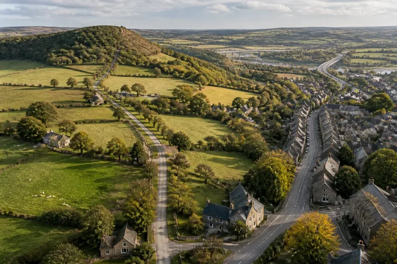
An old road can keep shaping a county map after carts, coaches or farm traffic stop using it. To read an old road on a county map, separate the line that survives from the journeys that line once carried: a straight track may remain visible even as new links redirect movement around it.
Consider a clearly invented county called Merevale. Its eastern market town, Alderby, once depended on a road running west to a ridge crossing and then on to a ferry at the county’s edge. The ferry has closed, a railway has altered travel between the towns, and a newer road now carries most through traffic. Yet Alderby’s local connections still gather around sections of the older route.
This case shows how to follow that pattern without mistaking a surviving trace for a complete account of past travel. The useful question is not simply whether the road remains. It is what parts of its former route have been preserved, adapted, bypassed or detached from their original purpose.
Start with the route’s visible line
On a county map, draw attention first to the road’s shape rather than its name. A long, relatively direct line may connect places that now appear to have little in common. Look for abrupt bends, gaps, changes in road width and junctions that seem oddly placed beside the routes carrying traffic today.
In Merevale, the old road leaves Alderby’s western edge in a straight line, climbs towards a low ridge, then bends sharply where it descends to the former ferry landing. A modern road skirts the ridge and reaches a bridge farther north. On the map, the older line therefore looks like a direct east–west connection, but its final section no longer leads to a working crossing.
That distinction matters. A map can retain a continuous-looking line even when some segments have become footpaths, private access roads or minor lanes. Conversely, a break in the present road network does not prove that the route was historically discontinuous. Map symbols describe current or recorded features, not every use a route has had.
To trace the line carefully, compare maps at different scales. A county map is useful for seeing the broad connection; a larger-scale map may show where a lane narrows, turns into a track or meets a path. For present-day orientation, an Ordnance Survey map can help distinguish mapped roads and paths, while older map editions, where available, can reveal whether a junction or settlement approach has shifted.
Follow the connections that survived
Roads do not persist only as roads. Their influence can remain in the smaller connections that continue to meet them: a lane leading to a farm, a footpath entering a village, or a street aligned towards a former crossing. These links may outlast the journeys that originally made them useful.
In Merevale, the old road remains important on the approach to Alderby. Several short lanes meet it near the town’s western edge, while the newer bypass connects directly to the bridge and the neighbouring county. The bypass is the stronger route for crossing the area, but local access still follows the older approach. The map therefore holds two networks at once: a through-route designed around newer travel and a local web that still uses pieces of the old alignment.
Look for the way side connections meet the main line. A series of entrances facing the old road may suggest that nearby properties remain oriented towards it, even if the road itself has lost its former through function. A path that joins the old line near a ridge crossing may preserve a local connection across difficult ground. These clues are suggestive, not proof of a particular historical use, so keep the observed pattern separate from any explanation you infer.
It helps to describe each segment by what it does now. One part might serve as a town street, another as access to fields, and another as a walking route. Calling all of them “the old road” can hide the fact that their present roles differ. A county map becomes easier to interpret when its continuous historical line is read alongside these distinct current functions.
Notice how the purpose changes along the route
A route can change purpose gradually. A road that once joined a market and a ferry might later serve the market’s western farms, then become a quiet lane after a bypass takes through traffic elsewhere. The road’s physical form can persist while its users, destinations and importance change.
In the invented Merevale case, imagine a resident walking from Alderby towards the ridge. At the town edge, the old road is a built-up street with several side lanes. Beyond the last houses, it narrows beside fields. Near the ridge, a surfaced section ends and a path continues towards the old crossing. The same mapped alignment has become a town connection, rural access and walking route in succession.
This change in use can explain why a route’s map appearance feels inconsistent. A thick road line may carry little traffic on one stretch, while a narrower road nearby serves more journeys. The map is recording a mapped category, not directly measuring how many people travel there or why. To understand the route’s role, examine its connections to destinations that still matter: homes, farms, local streets, crossing points and neighbouring settlements.
Do not assume that a newer route erased the older one. The bypass may have taken long-distance traffic away while leaving the old road useful for local trips. Nor should the older line be treated as a complete record of an earlier journey. A ferry approach may have shifted, a bridge may have replaced a ford, or a path may have followed a slightly different track. The map can show continuity of alignment without proving continuity of use.
Compare the old alignment with the newer network
To see how route choices shaped later connections, compare where the newer road meets the older one and where it avoids it. A bypass that joins an existing road at both ends may preserve the old route as a local loop. A new bridge may make a former ferry approach redundant while leaving its road in place. A railway station can also redirect local streets towards a new centre without removing the earlier road.
In Merevale, the bridge road meets the old route near Alderby but leaves it before the ridge. The change allows through traffic to cross by bridge, while the older line remains connected to the town and nearby farms. On the map, the old road is not simply a discarded predecessor. It has become one strand in a network whose main crossing and local access no longer share the same alignment.
A useful comparison asks three things. Which destinations can each route reach directly? Where do the routes meet or separate? Which side connections depend on the older line? Answering these questions makes the map’s present structure clearer without claiming that every bend or junction was deliberately planned to preserve an older pattern.
Say you are tracing this invented county on a paper map. You mark Alderby, the ridge, the former ferry landing, the bypass and the bridge, then follow every lane that meets the old road. You would expect to see that the older line still gathers local connections near the town, while the newer crossing carries the most direct link beyond the county. That observation explains the map’s shape; it does not establish the exact traffic or history of either route.
Which clues help explain an old road?
Does a straight line prove the road is ancient?
No. A straight alignment can reflect many practical choices, and a map alone cannot date it. Treat the line as a clue to investigate alongside its connections and changes in form.
Why does a bypass leave the old road in place?
A bypass can redirect through journeys without removing access to houses, farms or streets along the older line. The road may remain useful for local movement even when it is no longer the main route across the area.
How can I tell whether an old road still matters locally?
Look for present-day streets, lanes, paths and access points that continue to meet it. Their arrangement can show that the alignment remains part of the local network, though it cannot by itself explain every journey people make.
What does a map leave uncertain?
A map may not show why a route changed, how heavily it is used, or whether a modern path follows the precise historical line. Keep those questions open unless another reliable source answers them.
Read continuity without mistaking it for sameness
The old road in Merevale still shapes the county map because its line anchors connections that newer routes have reorganised rather than erased. The ferry is gone and the bridge now carries the cross-county link, but the older alignment still joins Alderby to its western approaches and neighbouring land.
When tracing an old road on a county map, note what persists and what has changed separately. Record the visible alignment, the present form of each segment, the destinations it now connects and the points where newer routes depart from it. That simple distinction lets a reader recognise the road’s lasting influence without treating an old line as evidence that its original purpose survives.
For a useful map note, describe a segment in present-tense terms: “lane to western farms”, “path towards the ridge crossing” or “town street connecting to the bypass”. Such wording keeps the road’s surviving role clear and gives the next reader a precise place to look, even if the route’s older story remains uncertain.